Bike ride to and along the river
Moselle
18/7/2000 - Metz
|
When you leave Metz by train and head south toward Nancy the
tracks follow along the river Moselle almost the entire
way. About 10 minutes outside of Metz you pass a set of Roman
ruins, including the remains of a giant aquaduct. I'd seen it
a couple of times, but I'd never really figured out where it
was.
Thus, the plan was born to hop on the bike after classes on
a Tuesday and ride southwest until I hit the Moselle, and then
ride downstream (to the north) until I found the ruins. I
didn't really have any maps, but I had a rough idea of where I
wanted to be and I had a compass, so I set out around 3pm.
|

|
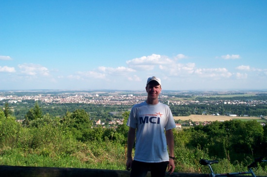
| |
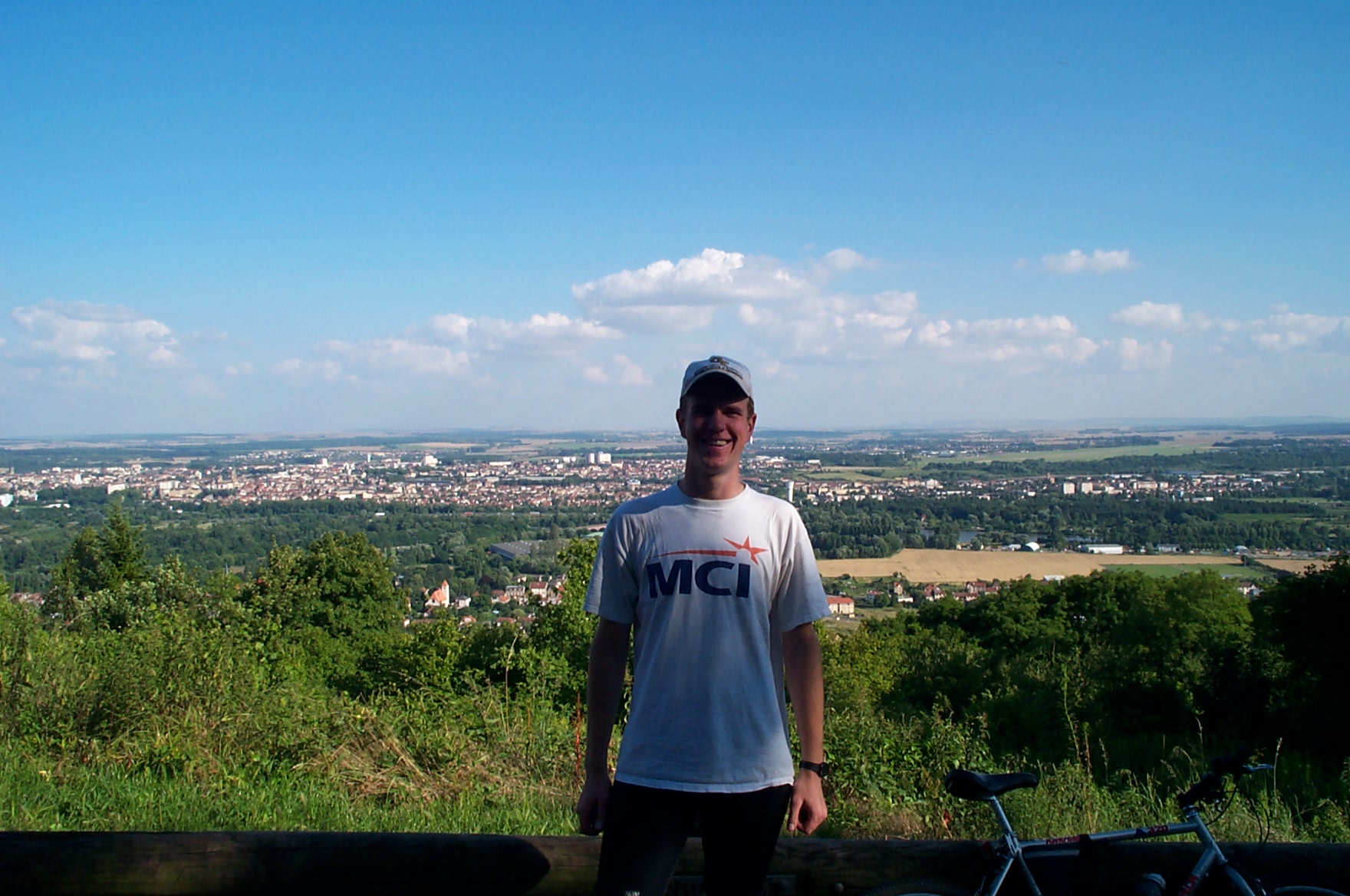
Me, on Mont St. Quentin near the end of the ride. Metz
is in the background. |
 [o
m]
[o
m]
|
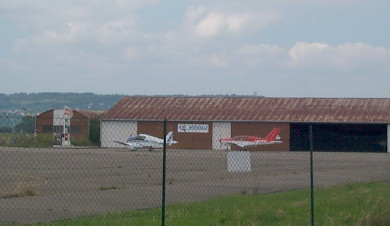
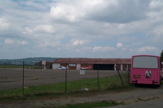
Along the way I passed by the Metz airport, which isn't too
happening. To be fair, the real Metz airport is the Metz-Nancy
regional airport, and it's a little further southwest and actually
carries a fair bit of traffic. This was just a little play field.
|
These are some of the planes there.
 [o
m]
[o
m]
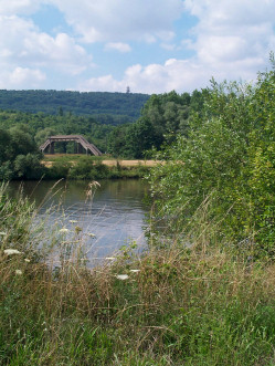
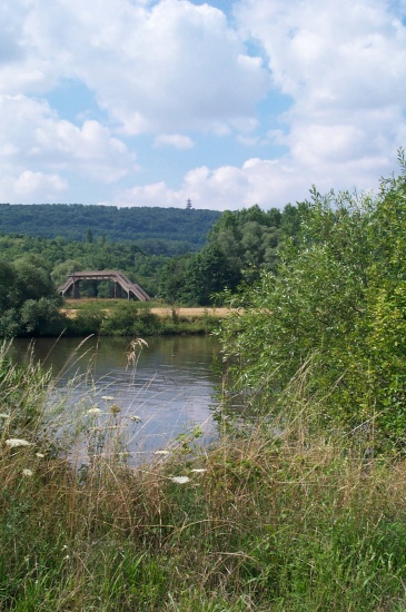
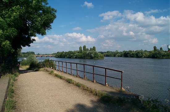
And this is a view of the Moselle (or a canal; I don't remember) with
a footbridge for crossing railroad tracks.
 [o
m]
[o
m]
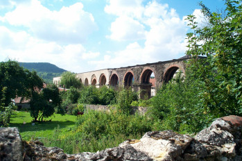
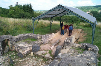
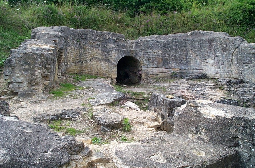
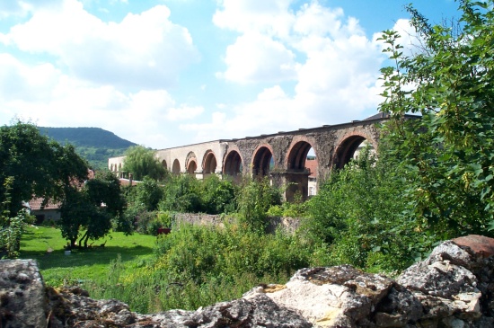
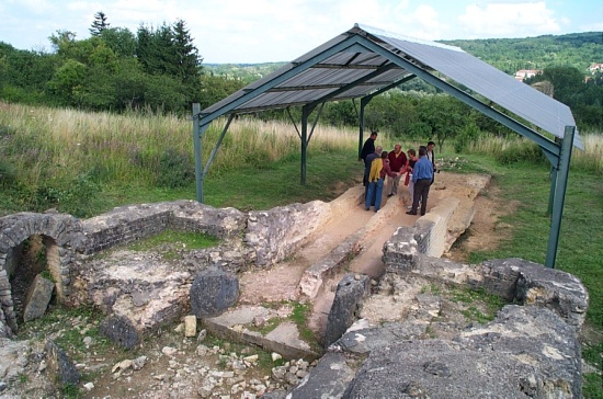
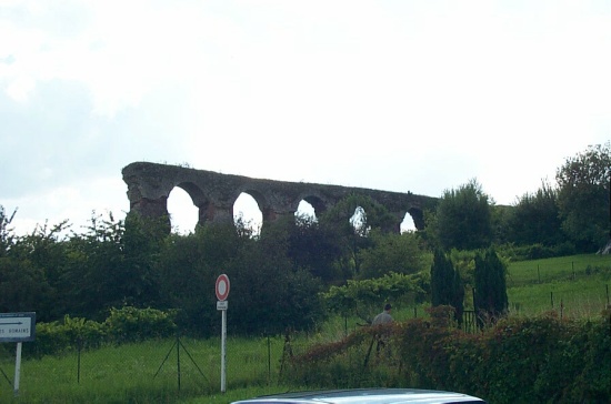
After about an hour or so of riding, I came upon the ruins. I passed
through several towns, such as Corny. This is part of the aquaduct
structure that is preserved under a rain cover.
 [o
m]
[o
m]
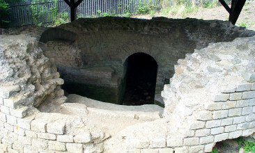
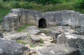
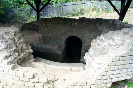
And this is a holding tank in the same area.
 [o
m]
[o
m]
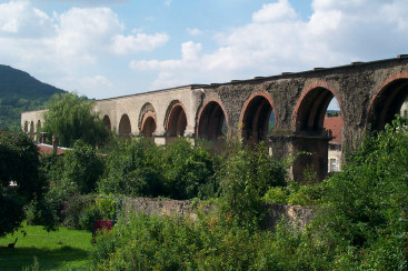
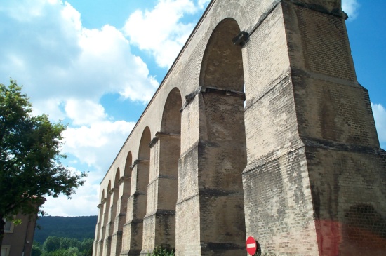
This is a shot of what the aquaduct looks like.
 [o
m]
[o
m]
And closer up.
 [o
m]
[o
m]
A view from the ground.
 [o
m]
[o
m]
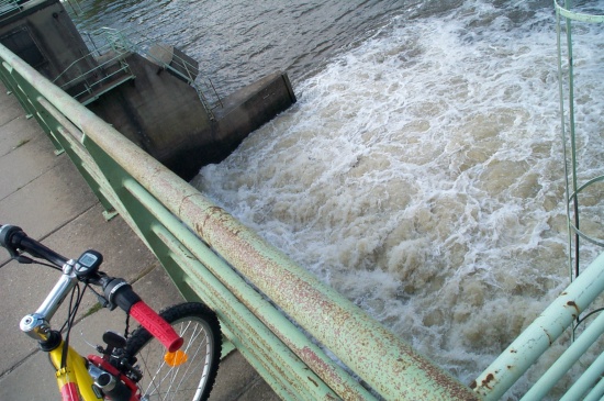
After visiting that side, I rode across the river on my bike and
stopped on the bridge. There was some sort of dam.
 [o
m]
[o
m]
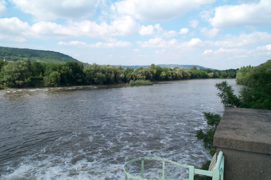
A view down the Moselle.
 [o
m]
[o
m]
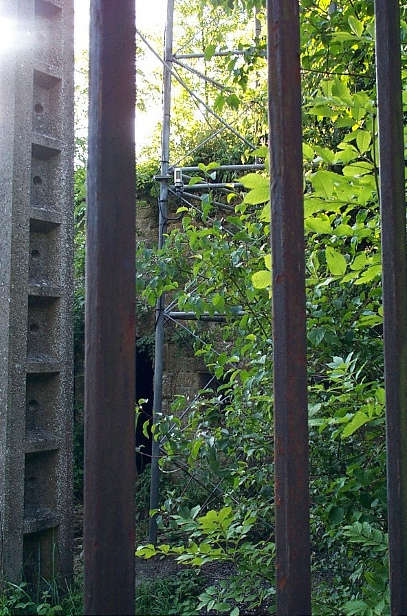
This is where the aquaduct goes into the hill, on the west side of the
river.
 [o
m]
[o
m]
More ruins.
 [o
m]
[o
m]
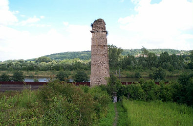
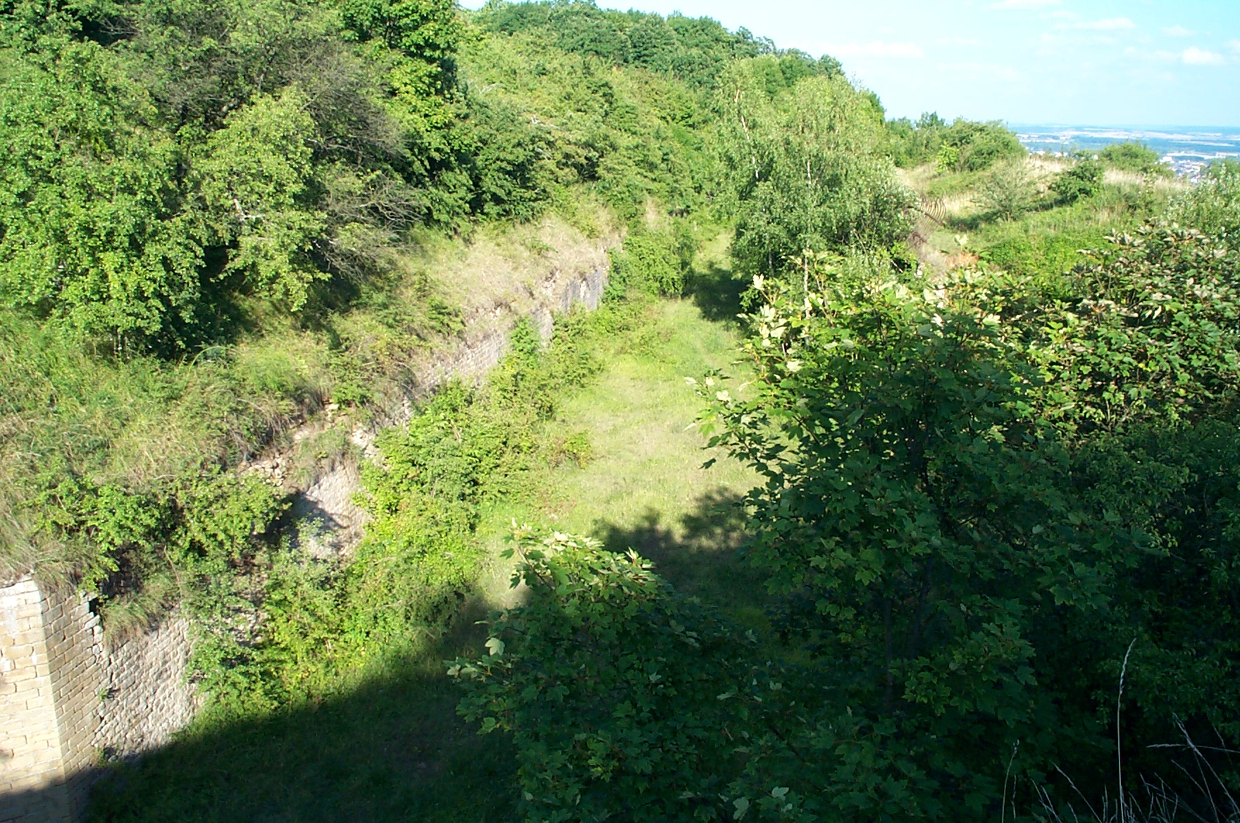
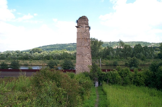
A lone standing support tower. This is the only one standing in this
part of the ruins; apparently the other parts of the aquaduct have
fallen down.
 [o
m]
[o
m]
The western side.
 [o
m]
[o
m]
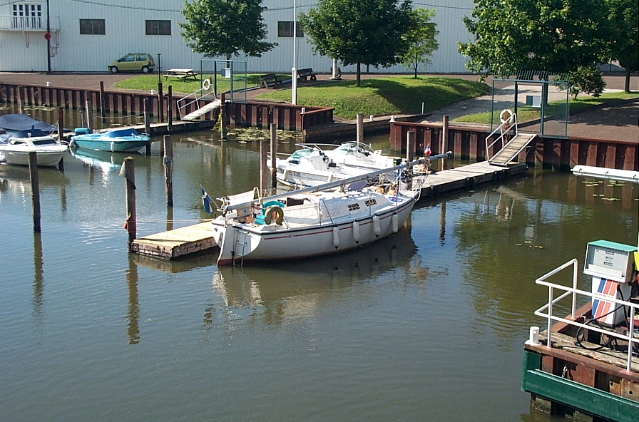
A marina I passed by.
 [o
m]
[o
m]
And another view of the river.
 [o
m]
[o
m]
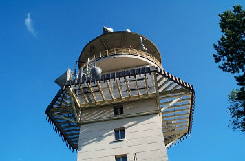
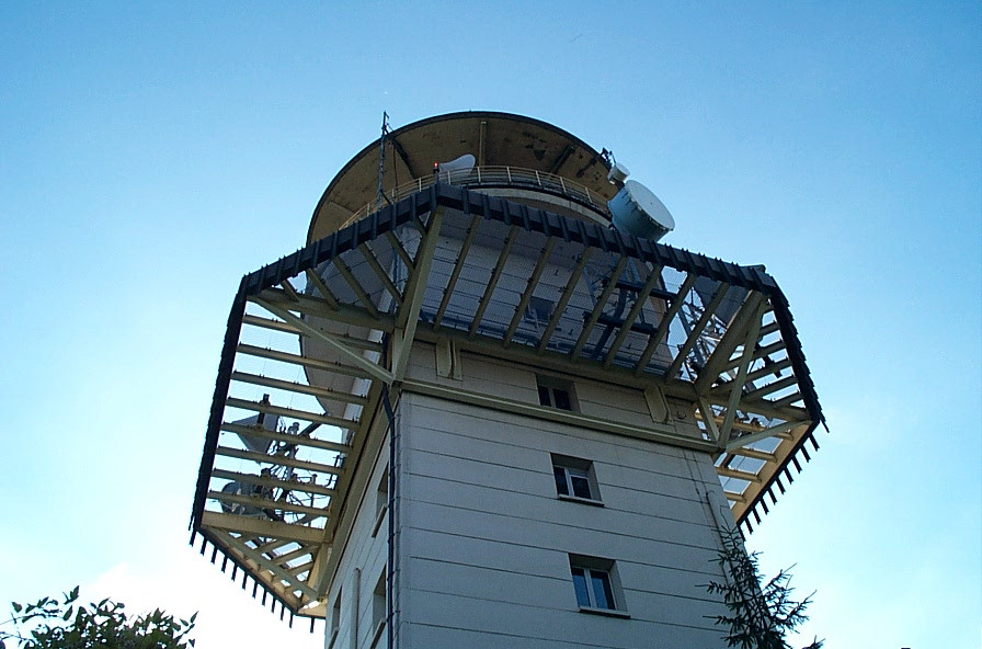
This is a shot of Mont St. Quentin. It doesn't look too impressive,
but it's a fairly good ride up to the top. The tower up on top will be
discussed later, but it's a France Telecom link tower that's big
enough for people to live inside.
 [o
m]
[o
m]
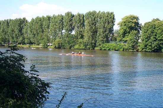
This is a crew boat on the Moselle.
 [o
m]
[o
m]
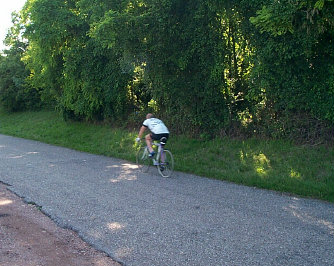
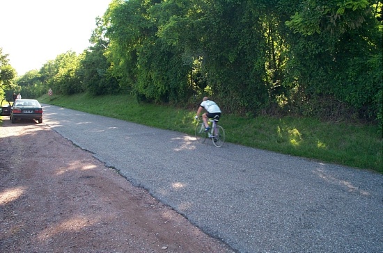
This is a guy cruising down the road at the top of the road up to the
scenic overlook (the following pictures are about 150° around from
this one). He was booking it -- probably at least 40 kph.
 [o
m]
[o
m]
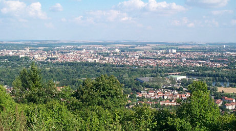
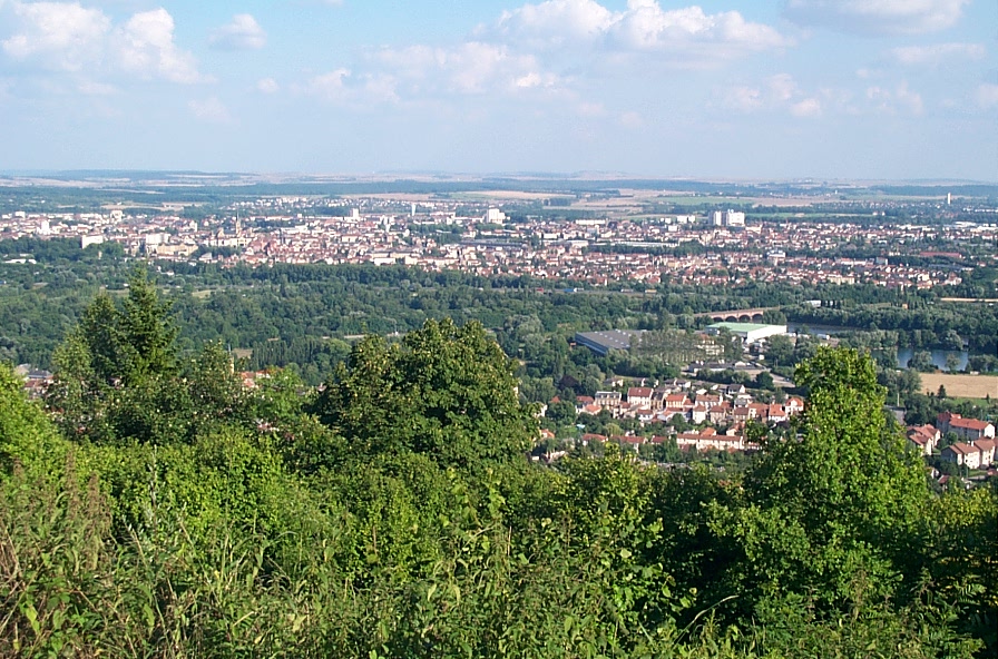
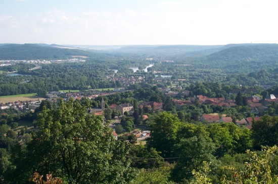
The town of Metz. The Technopôle isn't really visible in this
picture, but it would be to the right and pretty far back.
 [o
m]
[o
m]
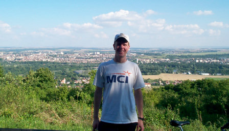
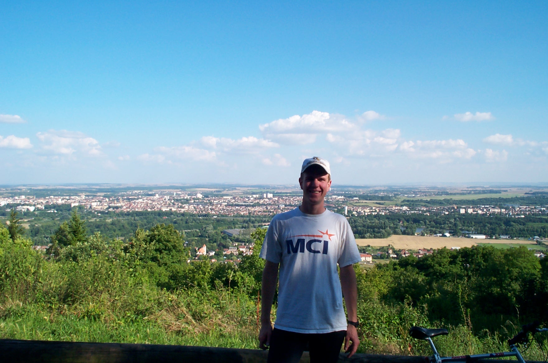
Me. Picture taken by another cyclist I met up there.
 [o
m]
[o
m]
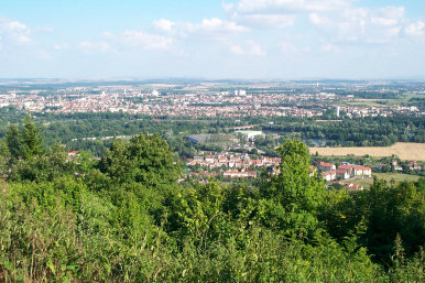
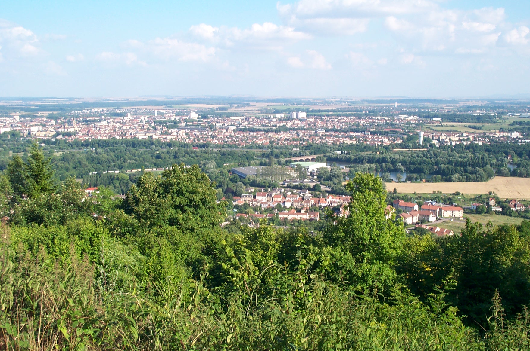
Another view of Metz.
 [o m]
[o m]
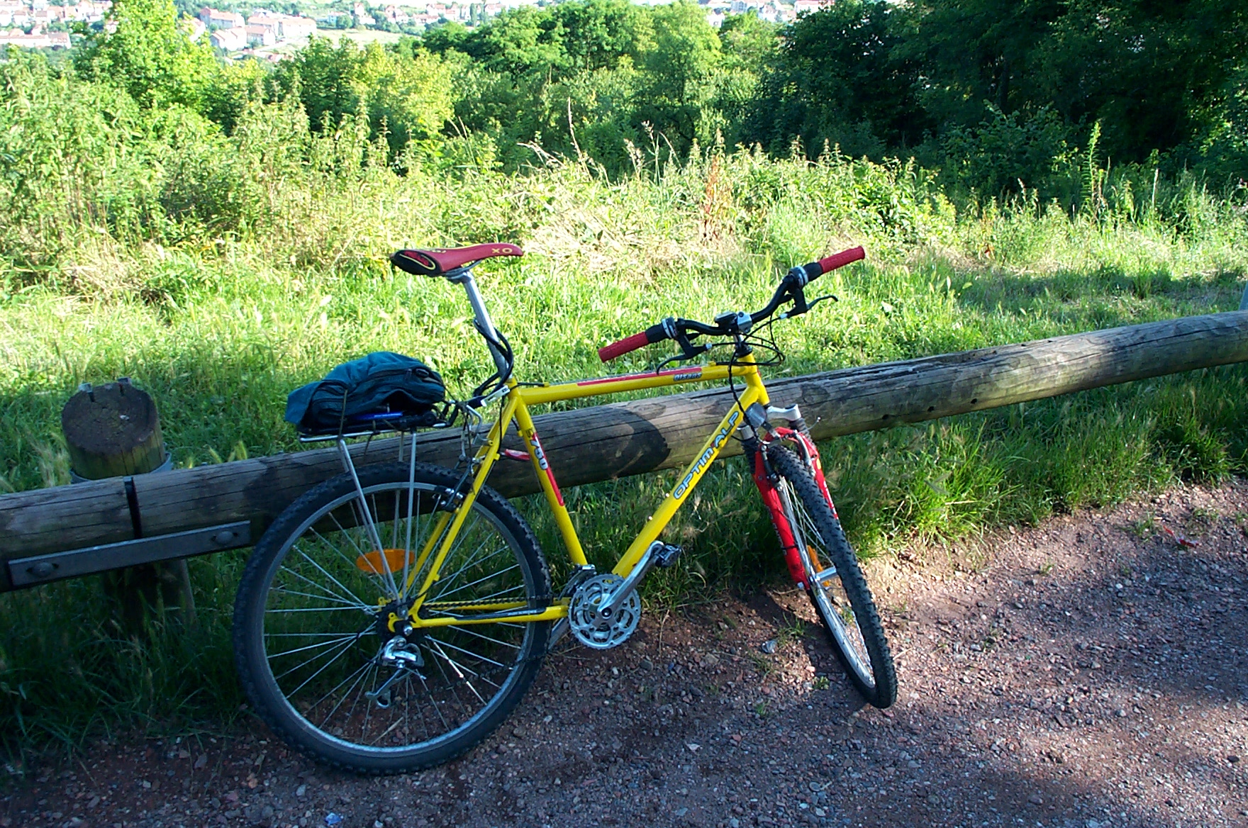
The bike, after the ride up to the top.
 [o m]
[o m]
A view to the south, along the Moselle.
 [o
m]
[o
m]
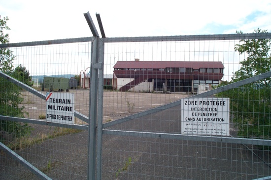
The dry moat around Fort St. Quentin. This was apparently something
built by the Germans after the Franco-Prussian war, and was really
interesting. As I mention later, the fort was quite occupied and they
didn't really want visitors (or me taking pictures).
This was the easiest way I could see to cross the moat, and it still
wouldn't have been trivial.
 [o
m]
[o
m]
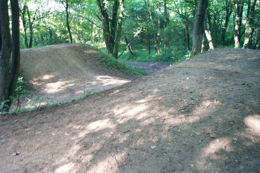
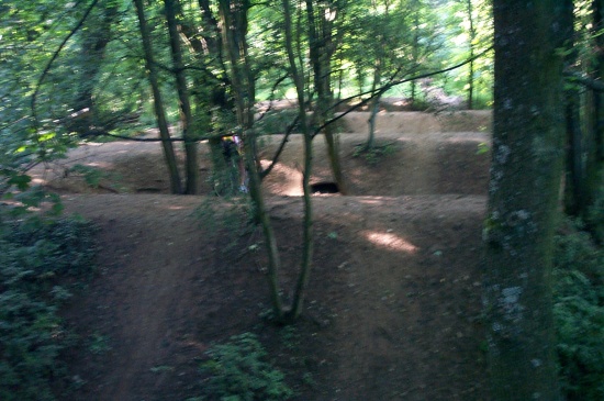
There's a big mountain bike club up here -- do a search for V.T.T and
Mont St. Quentin on the web and you'll find it. In any case, they had
some awesome sculpted trails and jumps. I actually came across this
one by accident, and didn't have time to stop before riding
it. Luckily I made it without a scratch, but one of the locals riding
didn't fare so well (although he didn't really get hurt or anything).
 [o
m]
[o
m]
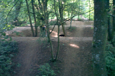
Here's another shot of the jumps. In the center of the picture you can
see a guy going down the second hill. From top to bottom I would say
the hills were roughly 1.5 m deep.
 [o
m]
[o
m]
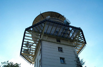
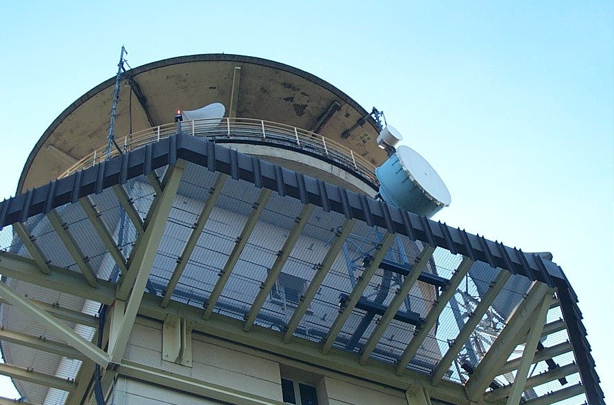
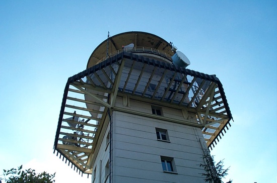
Ever wondered what the TDF tower looks like up close? I liked the
metal grating around the top of the tower, presumably to either keep
people from falling or to keep RF from scattering downwards into the
residences below. People actually lived in this thing.
 [o
m]
[o
m]
I had a friend (Agathe Battestini) do a word-for-word translation of
this sign for me:
Watch out!!!
No entry to the fortifications of Mont Saint Quentin, built up at the
begining of this century.
The settlement has been damaged by time and wars. There are wells,
collapses, escarpment that make the access and approach perilous.
The deconsecrated (I don't know 'desanne'...) work is not interesting, and
not attractive.
Respect roadsigns that aim to protect you.
An adult and a child died because they did not respect them.
Don't succumb to your curiosity.
You do it at the risk of your life.
 [o
m]
[o
m]
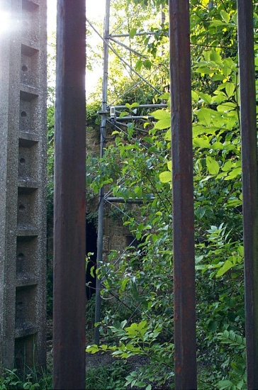
This was a motion sensor mounted on a tower. I know this because I set
it off when I was taking pictures through the gate and the guard drove
up with a jeep and a gun and politely asked me (in that universal
language of "gun") to leave.
 [o
m]
[o
m]
This is the gate that I was looking through. I decided to spite him
and take one last picture once he had crossed the hill.
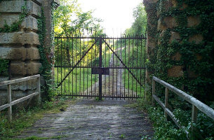 [o
m]
[o
m]
This is another view of the TDF tower.
 [o
m]
[o
m]
And closer up.
 [o
m]
[o
m]
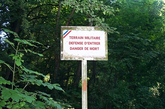
French for "no tresspassing", or more accurately, "Military area; no
entry; danger of death."
 [o
m]
[o
m]
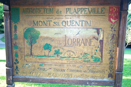
On a more pleasant note, this is a sign up near the park at the top of
the mountain.
 [o
m]
[o
m]
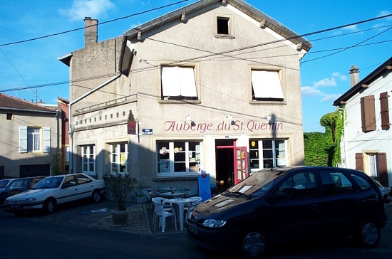
And this is a nice bar where I had a refreshing coke and relaxed for a
while.
 [o
m]
[o
m]
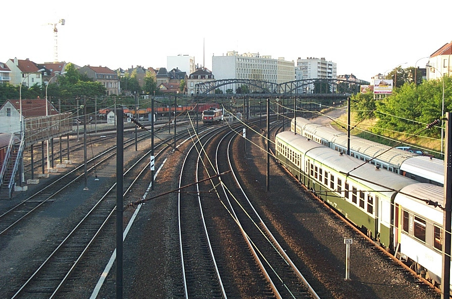
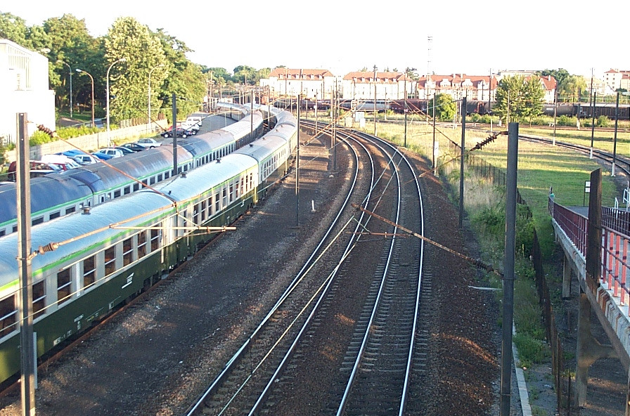
On my way back I crossed through the SNCF rail repair yard and got a
chance to look a few electric locomotives disassembled. I didn't take
any pictures, but these are the tracks going either way as you walked
over things.
 [o
m]
[o
m]
A view to the south.
 [o
m]
[o
m]
As usual, you can get the thumbnails.
All pictures and text copyright © 2000
Peter Jensen. Please refer to
the main page for details.


